The July 30 pressure wave / 100km Alpstein FAI
Risk mitigation: A homage to modern (in-)flight information systems.
Technology is often considered unromantic in mountain sports, but some hassles are well worth it.
Tech Aversion in Mountain Sports
I am under the impression that there’s still a rift in the mountain sports and paragliding communities regarding the usage of technology. Devices and resources are sometimes waved aside as unnecessary, obtrusive or unromantic. After all, LCD screens distract us from true adventure and genuine experiences in nature, right? Mountaineers and pilots thereby miss out on safety enhancing, possibly life-saving technologies.
On July 30 2026, large parts of Europe were affected by a dry air pressure wave. Violent wind gusts originated from an array of thunderstorms cells over France and swept eastwards without any warning signs: No clouds, no steady increase in wind speeds, just life-threatening air conditions from one second to the next. This rare occurrence was predicted by the ICON models, albeit the exact timing remained a bit uncertain. It caused a stir on social media, most of the pertinent weather apps and services posted warnings about the following day.
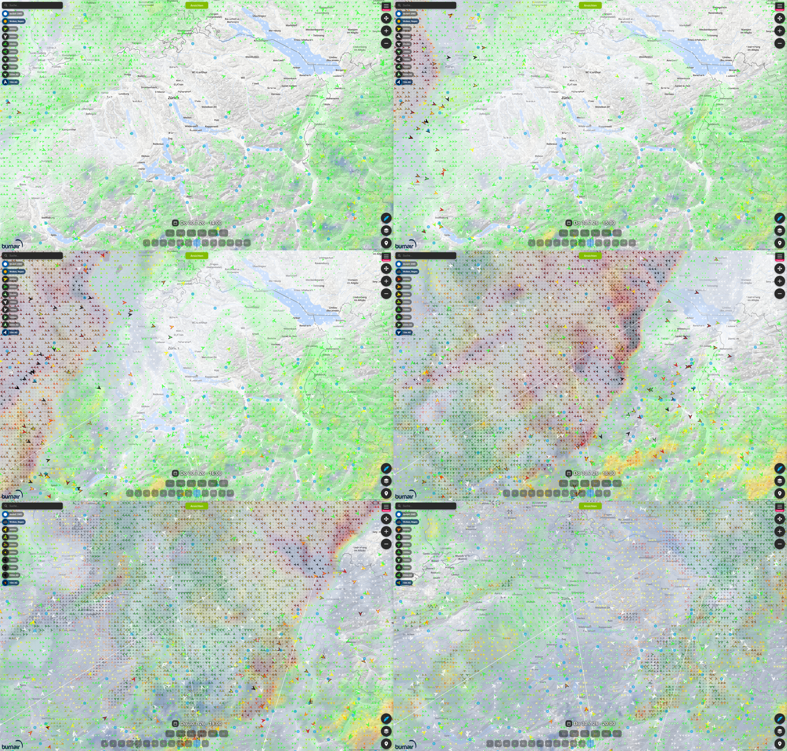
Takeaway 1: Do an exhaustive meteo briefing. Every single time. No exemptions.
Days like this prove that you will never outsmart modern weather models even with years of experience on your local site. There’s a nonzero chance that things turn bad in ways you won’t see coming. Depending on your planned activity, proper “state of the art” planning preparation likely requires a (paid) subscription to a specialized weather service. That’s a small price in comparison to the potential cost of an accident.
Thorough weather briefings are already a point of contention. People sometimes justify subpar preparation because their plans are allegedly a special case. “It’s just a quick hike and fly!” Sure, conditions the last 30 minutes might have been calm, but that could have led to a severe accident on July 30. Preparatory weather checks are mandatory whether you’re hiking, mountaineering, crosscountry- or speedflying. Only if you know exactly what’s coming, you can manage risks with adequate safety margins. This, on the other hand, opens up potentials on less than ideal days.
In-Flight Hassle vs Reward
While solid preparation is out of the question, I’d actually distinguish the recommended PG tech based on the planned activity. Short glides or even speedflying won’t give you much chance to check for weather updates. The measurement intervals are just too long, you’re busy flying and local indicators (trees, windsocks etc.) are just better scoped.
As soon as there’s a chance to thermal upwards or even dip into XCish terrain, I’d argue that in-flight weather information systems become sensible. Looking at the animation above, we can see that the measured wind speeds (isolated arrows) were actually increasing ahead of the predicted pressure wave. While modern weather predictions are pretty good, live weather updates still provide significant safety benefits. As depicted below, there were really no warning signs about the incoming danger.
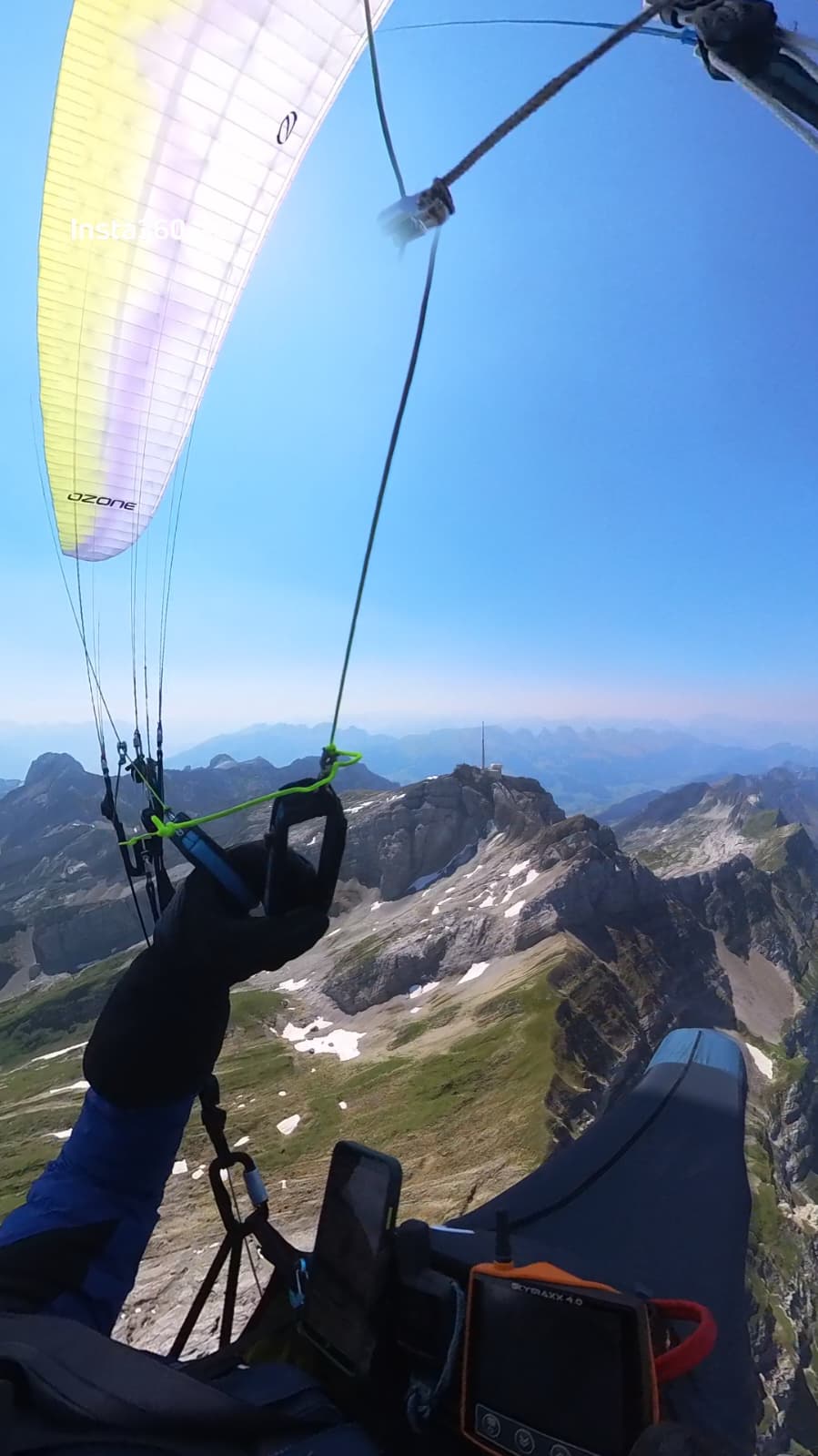
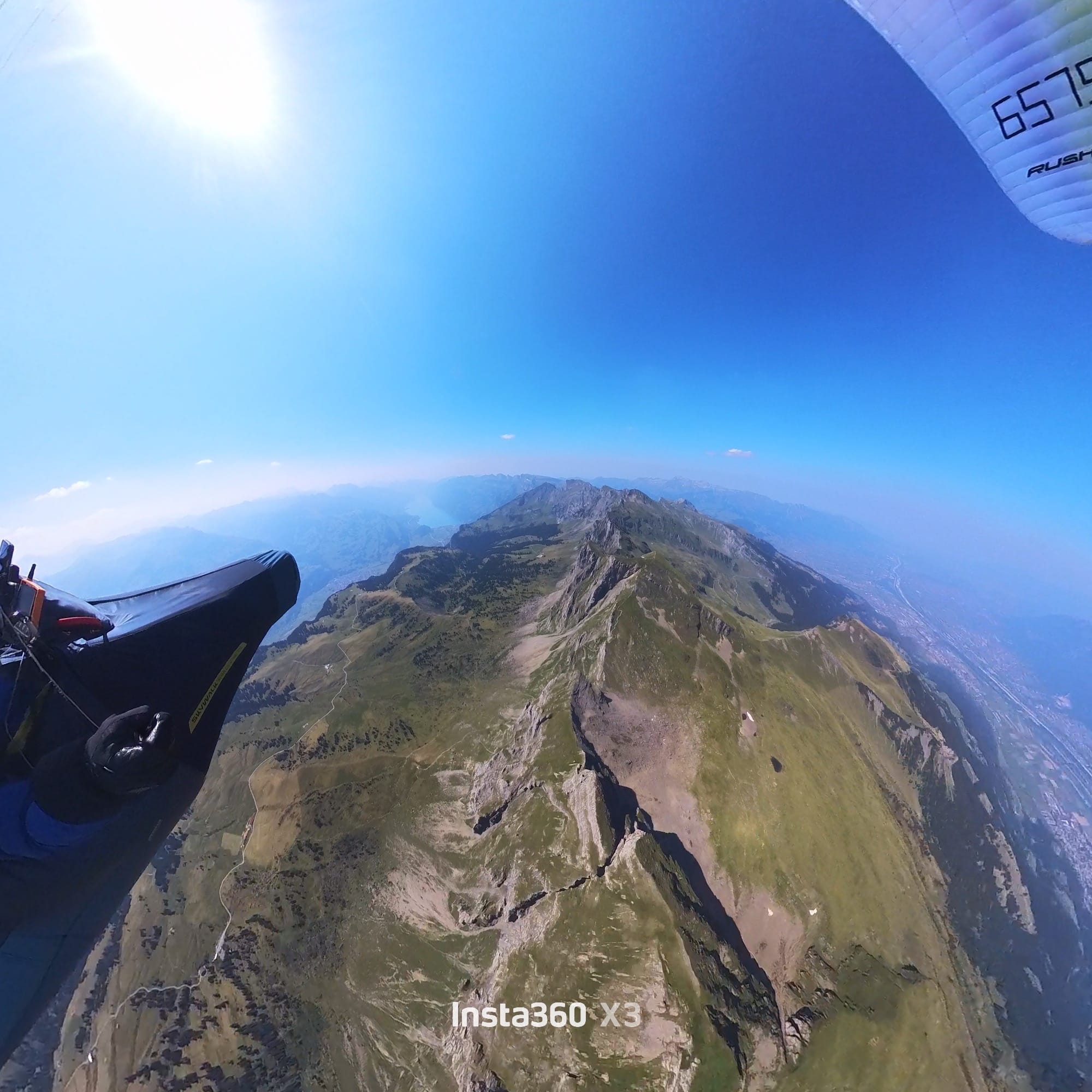
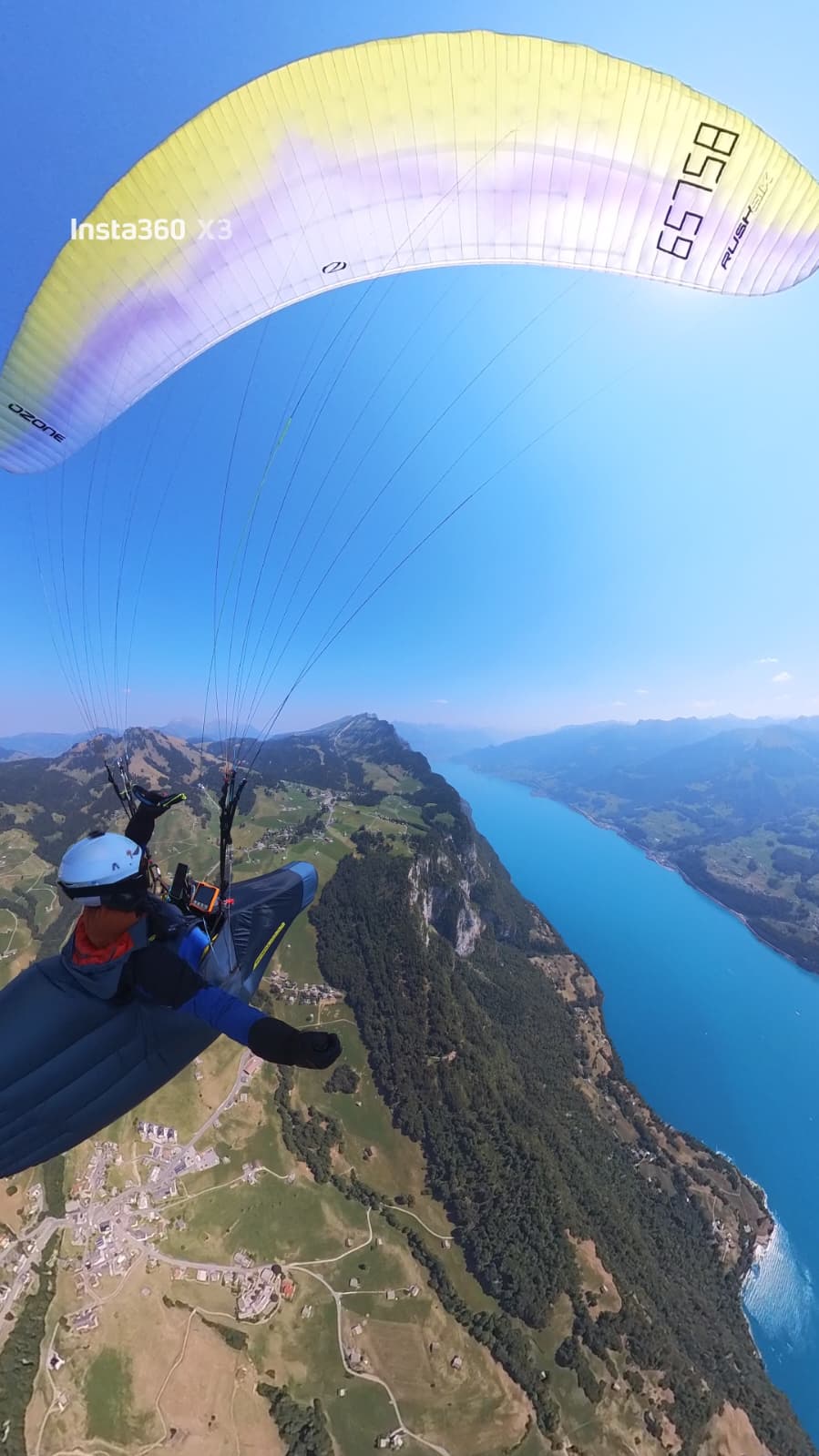
Takeaway 2: Anything that could turn into a longer thermal or XC flight warrants in-flight weather data.
Collision Avoidance Systems
Collision avoidance systems based on FLARM and the newer ADS-L systems are not as widely adopted as one would expect in 2026. Granted, between paragliders they’re often useless: when thermalling together you just have to stay vigilant and collisions in low-visibility conditions (e.g. being sucked in a cloud) should not happen in the first place. But paragliders share the airspace with faster aircraft, whether it be sailplanes, motorized sporting planes, helicopters or even low-flying military jets.
A spectacular collision between a paraglider and Cessna in May shows that this is not a purely theoretical concern. If you’ve ever wondered whether that sail plane over there had actually seen you or when jets in the clouds above sounded too close for comfort you probably pondered on getting a vario with FLARM/ADS-L. Hopefully you acted on that thought. Caveat emptor: Currently there’s no guarantee other aircraft will actually use and see you on the necessary receivers. There’s rumors regarding mandatory electronical identification measures for paragliders in Switzerland. This has the potential to replace the unpopular stick-on labels. For U spaces that will be shared with autonomously flying drones, there will be no way around ADS-L anyways.
Takeaway 3: At least for thermalling/XC, get an FLARM/ADS-L transceiver.
Online Tracking and Distress Calls
The last puzzle piece of in-flight electronics/services that comes to mind is online tracking. If you’re using FLARM/ADS-L this is potentially covered through OGN receivers already, depending on your region. Alternative are GSM-based, e.g. the rega app or Burnair. These all rely (more or less) on a line of sight to a corresponding cellular transmitter. That’s already an enormous benefit: the search radius for a rescue operation can be narrowed down significantly if your last airborne position is known. There’s simply no excuse to take off without app-based live tracking enabled.
The last failure mode is rooted in the unavailability of terrestrial radio networks. In the air, cell coverage in the Alps is pretty good. In the event of a reserve deployment and a rough landing somewhere on a glacier you have a good chance to be found at some point if you had a GSM tracker running and someone notices that you’re out way longer than anticipated. The key advantage is time: being able to call for help immediately even without network coverage might be a life-saver and cold nights can turn threatening.
There’s multiple vendors for satellite communication that bridge the last remaining gap. The Iridium and Globalstar networks have global coverage, others are more region specific. Pick carefully, depending on your location. For adventures in remote areas these are a must-have.
Takeaway 4: Get a satellite communicator as soon as you start solo XC flying.
Common Counterarguments
I think a major point essentially boils down to not wanting to deal with yet another complicated piece of equipment, i.e. laziness. We should overcome this as a community. Another counterargument is the price point: Granted, a complete setup isn’t cheap. But considering the possible consequences of a paragliding accident I think it’s well invested and not paying off on a personal level, but also for the entire community.
The safer paragliding is, the less severe the consequences weather forecast misinterpretations and accidents become, the fewer ramifications and resultant regulations will we see as a community. Maybe we should adapt the “all the gear, all the time” credo from motorcycling.
The 100km FAI Triangle on July 30
Despite the pressure wave prediction I went flying on July 30. Absolutely fantastic day. Would have been nice to fly to Lucerne or Interlaken, but I obviously turned around and opted for the 100km triangle instead. The pressure wave was clearly visible on live weather in-flight.
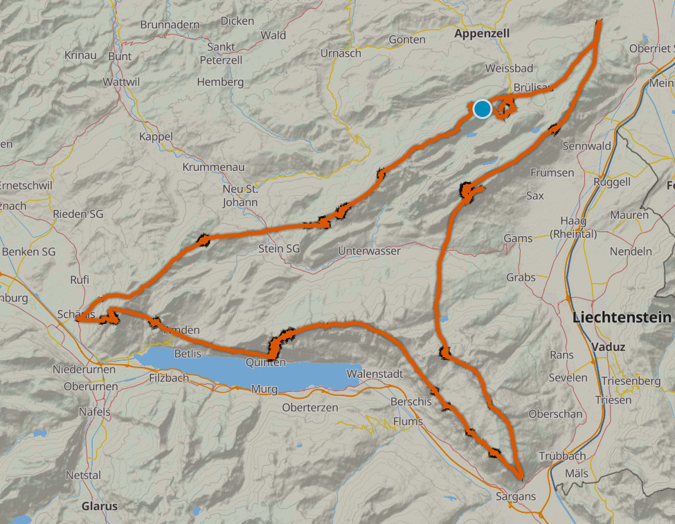
Full logs are available on DHV XC, xcontest and Burnair 3D